Every tree. Every acre. One platform.
Satellite imagery, AI detection, irrigation planning, and disease monitoring — from canopy to root.
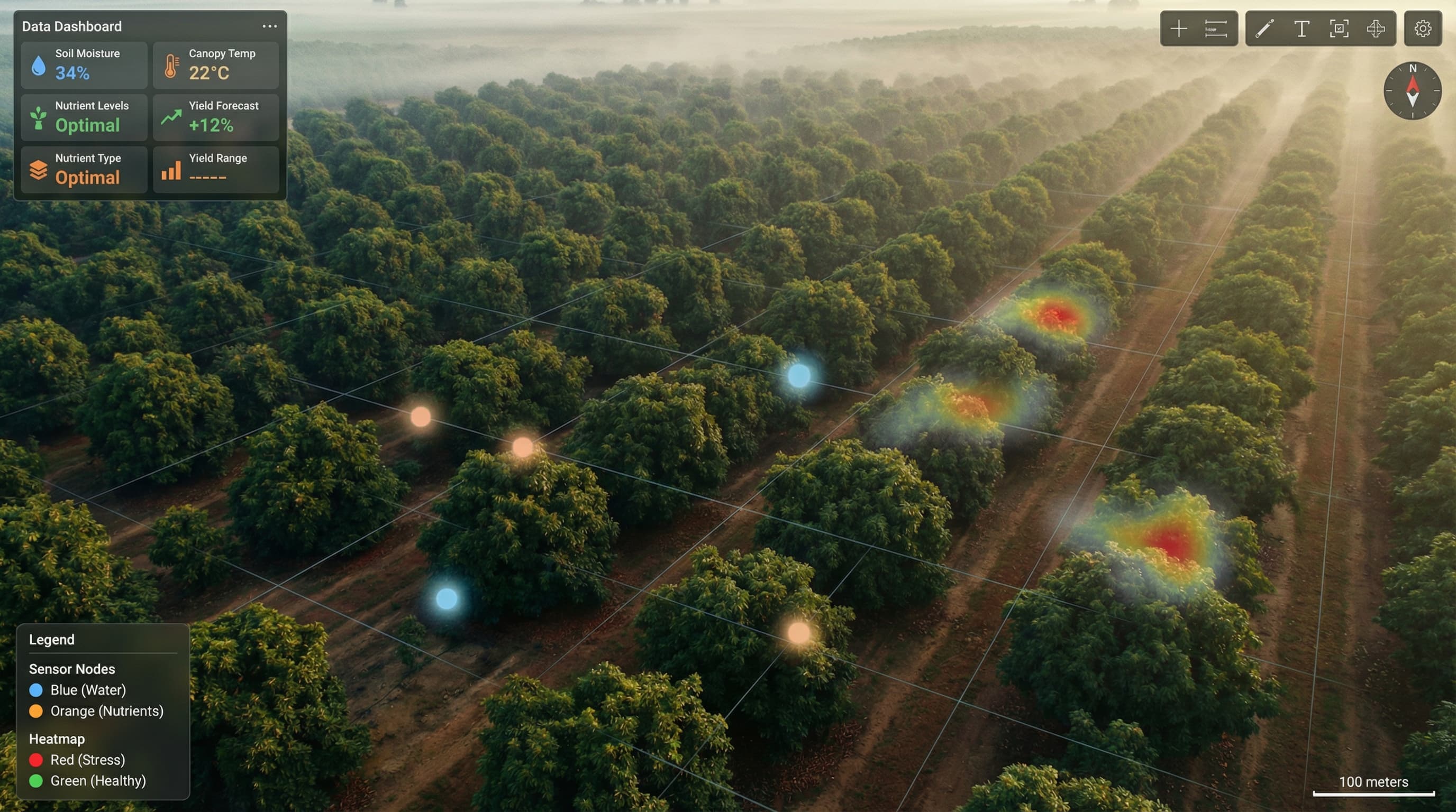
How It Works
From satellite to insights in minutes. Watch our AI detect and analyze your orchard.
Satellite Imagery
We pull high-resolution satellite imagery of your farm, updated regularly.
AI Detection
Our YOLO-powered model scans the imagery and detects every tree.
Tree Mapping
Each tree is mapped with GPS coordinates and health indicators.
Smart Insights
Get irrigation recommendations, health alerts, and yield predictions.
Cut Costs. Meet Compliance.
SGMA extraction tracking, FSMA traceability, and ET-based irrigation - all in one platform built for California agriculture.
EagleView
Satellite Intelligence
See your entire farm from above. Our satellite integration delivers high-resolution imagery updated regularly, giving you a bird's eye view of every acre.
- Multi-spectral imagery analysis
- Historical comparison views
- Zone-based management
- Export to GIS systems
TreeDetection
AI-Powered Mapping
Our YOLO-based machine learning model detects and maps every tree in your orchard. Get precise GPS coordinates, canopy size, and health indicators for thousands of trees in minutes.
- 98% detection accuracy
- Health status classification
- Canopy size estimation
- Missing tree identification
AquaSmart
Save Money, Stay Compliant
Cut irrigation costs with ET-based recommendations. Track water extraction against SGMA allocations and generate GSA-ready reports automatically.
- ET-based irrigation scheduling
- SGMA extraction tracking
- GSA report generation
- Cost savings dashboard
DITA
Disease Detection
Early detection of disease and pest infestation. Upload photos or let our satellite analysis spot problems before they spread across your farm.
- Photo-based diagnosis
- Satellite anomaly detection
- Treatment recommendations
- Spread prediction models
Results That Matter
California farms are cutting costs and meeting compliance requirements. Join the growers who chose Persea.
Ready to Transform Your Farm?
Get a personalized demo tailored to your farm's needs. See how Persea can help you save water, detect problems early, and make smarter decisions.
30-Minute Live Demo
See Persea in action with your farm's data
Custom ROI Analysis
Calculate potential water and cost savings
Free Trial Setup
Start analyzing your farm within 48 hours